
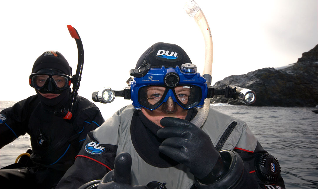
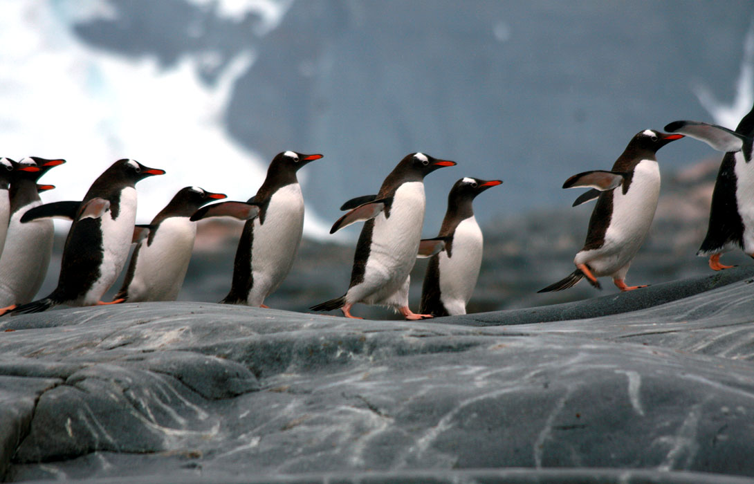
I was snorkeling in a gin-and-tonic mix of brash ice near a gentoo penguin colony in Antarctica, in February 2010, when a leopard seal charged me, not once but three times, its mouth agape and jaws seemingly detached. Squaring off face-tomask— the leopard seal’s face, my scuba diving mask—I counted the freckles on the animal’s upper palate and inspected its deadly tri-serrated teeth.
Charismatic predators of the Southern Ocean, leopard seals weigh in at 1,400 pounds and they can dispatch a 40-pound penguin in mere seconds. In order to get up-close-and-personal with these beautiful creatures, snorkelers brave -2 degrees C waters and hang out with penguins, their primary prey.
I held my ground (and my breath) during the three consecutive bluff charges, pulling my arms towards my core and diverting my eyes downwards. Once the animal determined that I was neither predator nor prey, an underwater ballet ensued between this graceful animal and the not-so-graceful snorkeler. It was a magical moment that I’ll never forget.
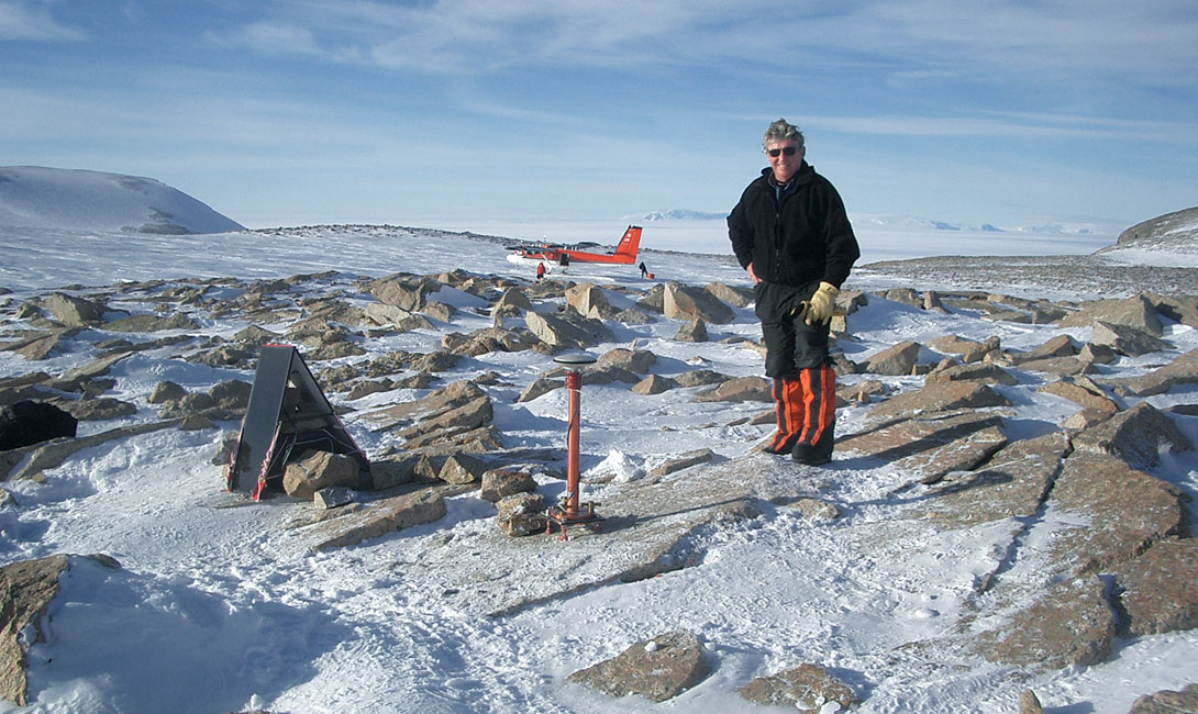
Bitten by the polar bug, I return to Antarctica from December 29, 2012 to January 19, 2013, participating in my third Antarctic expedition since 2010—and my second CSEG Foundationsponsored expedition—entitled Antarctica, South Georgia and the Falkland Islands Scotia Arc Tectonics, Climate and Life. Led by Dr. Ian Dalziel, professor of geological sciences at the Jackson School of Geosciences (University of Texas at Austin), the expedition will focus on the interplay between geology, geophysics, glaciology, plate tectonics, climate and life.
Hanging up my mask, fins and snorkel, I’m intent on exploring Antarctica from above the water, with my feet squarely planted on terra firma.
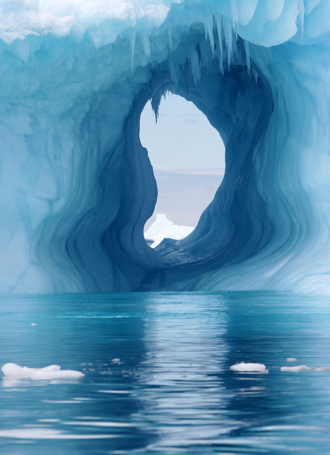
The world’s final frontier, Antarctica represents an outstanding outdoor laboratory to research planetary processes, including the impacts of climate change and ocean change. During the past fifty years, the Western Antarctic Peninsula has warmed 3 degrees C, triggering a cascading series of geological and biological changes in this fragile ecosystem which have global implications.
During the past two years, I’ve used Antarctica as an experiential teaching platform, speaking to many of the CSEG’s key stakeholders about the pivotal role that geoscientists play in studying climate change and ocean change. Whether presenting to an audience of 2,100 junior high school students in Calgary— who enthusiastically drummed their feet on the Southern Alberta Jubilee Auditorium floor as I walked onto the stage—or speaking to the New York Explorers Club, my role, as a geoscientist, is to translate what I learn in Antarctica, educating and empowering people to formulate scientifically-driven global solutions for today’s social, economic, energy and global sustainability challenges.
I invite the CSEG’s members and stakeholders to join me, virtually, as I explore the Bottom of the World.
Antarctic Peninsula, South Georgia and the Falkland Islands Scotia Arc Tectonics, Climate and Life
Organized around the 125th anniversary of the Geological Society of America (GSA), the Jackson School of Geosciences (University of Texas at Austin) and the GSA have assembled a world-renowned group of earth science professors from the Jackson School of Geosciences, Stanford University, Pennsylvania State and the Federal University of Rio de Janeiro. The Expedition begins in the Falkland Islands, and continues to the island of South Georgia and the Western Antarctic Peninsula (the three areas constitute the “Scotia Arc”).
Dr. Sharon Mosher is the Dean of the Jackson School of Geosciences and chair of the GSA’s 125th anniversary celebrations. “In honor of the GSA’s 125th anniversary, we’ll be celebrating advances in geoscience — our science, our societal impact and our unique thought processes — with a series of meetings, field trips and publications throughout 2013.” Added Mosher, “We decided that it was only fitting to have the inaugural event be a grand expedition to one of the most remote and fascinating geological areas which surrounds the Scotia Sea.”
Mosher explained that a similar trip, celebrating the International Geologic Congress in 1989, spawned decades of research on Rodinia, the supercontinent that existed between 1.1 billion and 750 million years ago. “Who knows what new ideas we will discover on this voyage? “The Jackson School of Geosciences is proud to help sponsor this historic trip,” said Mosher who is participating in the Scotia Arc Expedition.
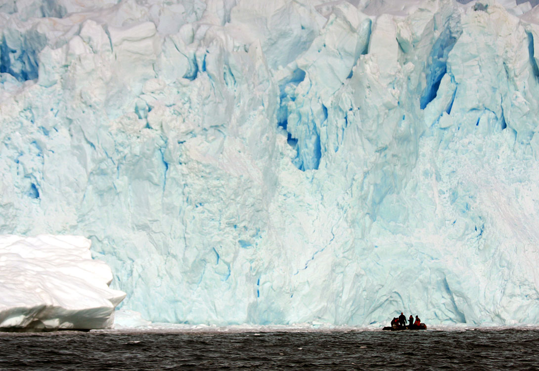
One hundred intrepid explorers from 15 nations will travel — on a voyage of discovery for 22 days — aboard the MV Akademik Ioffee, a 117-meter-long, Russian ice-strengthened vessel. The explorers will study the dynamic Earth, and the relationship between plate tectonics, glacial processes, climate and life. And, they’ll experience numerous Serengeti moments, witnessing some of the largest concentrations of wildlife on the planet.
Dr. Ian Dalziel, the expedition’s scientific leader, is a research professor with the University of Texas Institute for Geophysics and a Fellow of the Geological Society of America. Dalziel has over 40 years of Antarctic experience in plate tectonics and volcanism. A self-described “old-fashioned structural geologist,” his Antarctic research involves studying the interaction between plate tectonics and the environment.
“Climate change is happening,” said Dalziel. “There are uncertainties, and we’re trying to quantify them.” Added Dalziel, “One thing that earth scientists bring to the table is the dimension of time.”
Rapid warming of the Western Antarctic Peninsula has attracted global scientific attention, and geoscientists, biologists and oceanographers are working together to quantify the changes taking place in our planetary environment—these changes involve the interplay of the solid earth, ocean, atmosphere and biosphere.
Describing Antarctica and the Scotia Arc as the “nexus of the world’s great climate engine,” Dalziel said: “You can’t understand the climate unless you understand the solid Earth. Things happening in the interior of the Earth can impact the surface of the Earth in a way that biology cannot.”
Dalziel’s research quantifies isostatic rebound of the land below Antarctica’s continental glaciers, and suggests that it’s occurring at a rate of one millimeter per year. Using airborne gravity surveys and a network of on-the-ground seismic stations, he measures the density of Antarctica’s continental ice sheets and of the underlying Earth’s crust and mantle. Dalziel’s recent geological and geophysical investigations indicate that Antarctica’s continental ice sheets may not be thinning as rapidly as satellite images from space have previously measured.
Experiencing Big Ice in Action
Dr. Robert Dunbar is one of the expedition’s scientific lecturers. Dunbar is the W.M. Keck Professor of Earth Sciences and the Victoria P. and Roger W. Sant Director of the Earth Systems Program at Stanford University. He’s also the J. Frederick and Elizabeth B. Weintz Fellow in Undergraduate Education and a Senior Fellow at the Stanford Woods Institute for the Environment and the Institute for International Studies.
A marine geologist, Dunbar has travelled to Antarctica more than 31 times during the past thirty years. He studies the impacts of climate change — both today and in the geological past — from the tropics to the poles.
Specializing in paleoclimate and biogeochemistry, Dunbar runs the Stable Isotope Lab at Stanford University. His research attempts to quantify heat transfer from the warmest to the coldest parts of the planet. Descending in submersible submarines to 2,000 meters in the deep ocean, Dunbar has explored and documented this rarely-seen underwater world. He’s made 14 deep dives and has discovered, on average, a couple of new species during each dive.
Dalziel and Dunbar believe that increasing levels of atmospheric CO2 translate to ocean warming. Acting as a huge heat sink, the ocean transports this extra energy to the Antarctic ice shelves and glaciers. “Heat storage in the ocean comes from climate change,” said Dunbar.
“When you visit Antarctica, you get a sense of the rate of change that’s possible,” said Dunbar of the warming of Antarctica at a rate that’s eight times that of the global average.
Dunbar is a proponent of teaching in the field and “on the ice.” Participants, he said, will be blown away by experiencing “big ice in action.”
Dunbar describes glaciers—and the icebergs that they spawn— as “equal opportunity transporters” of sediments from the land to the continental shelf. Most geologists, he said, view turbidite flows as the primary mechanism for offshore sediment transport. “I’m always amazed by the transport capabilities of ice.”
In order to reconstruct Antarctica’s paleoclimate and predict future climate change, Dunbar has drilled (and cored) through the Ross Ice Shelf, the largest floating ice shelf on Earth. Not only has he drilled through the ice shelf—it’s the size of Alaska—but he’s drilled through the underlying water column and 1,300 meters into the unconsolidated, sea floor sediments which often contain boulders measuring 50 cenitmeters across. Dunbar describes this ground-breaking research as “drilling back into the future.”
Dubar’s paleoclimate reconstructions—from ice and sediment cores and from biogeochemistry—show that the Western Antarctic’s ice shelves have melted, completely or almost completely, thirty to forty times during the past three to four million years, precipitating a sea level rise, each time, on the order of six meters.

One-hundred Years of Geosciences in Antarctica
A century ago, Sir Ernest Shackleton’s scientific teams were comprised of geologists and geophysicists who explored Antarctica because it was there, and because it was unclaimed by any nation. During the heroic age of Antarctic exploration, geoscientists discovered volcanoes, mountain ranges, fossils, coal and minerals in this uncharted continent. And, in 1909, geoscientists in Shackleton’s Nimrod Expedition planted the British flag at the Magnetic South Pole.
Antarctica still contains many geological secrets: in 2009, Columbia University’s Lamont-Doherty Earth Observatory Institute deployed an airborne gravity system in Antarctica’s Gamburtsev Province, discovering sub-glacial ghost mountain ranges—extending 800 kilometers or the length of the European Alps—and sub-glacial lakes.
One hundred years later, Antarctica is still unclaimed by any nation. This mysterious continent belongs to citizens of the world and is development-free until 2041 when the Madrid Protocol, declaring it a place for peace and scientific endeavors, expires.
Today, geoscientists explore Antarctica, not because it’s there, but because it might not be there—in its icebound majesty—in the future.


Join the Conversation
Interested in starting, or contributing to a conversation about an article or issue of the RECORDER? Join our CSEG LinkedIn Group.
Share This Article