This year's SEG summer research workshop took place August 1-6, 1993, in Rancho Mirage, an exclusive golf and country resort situated in the southern California desert area. The day most of the participants arrived, the Palm Springs airport was shut down at 5 pm due to over-heating of the tarmac. It was no less than 125 degrees F when a few colleagues and my family finally dipped in the hotel's pool which was also warm beyond the point of being refreshing. The venue of the workshop was the hotel resort Marriott situated obviously on one of the town's most famous golf courses and on Bob Hope Blvd! A few daring participants tried their hand at the golf club, but after a few minor incidents of heart failure and heat stroke, returned to concentrate on the air conditioned workshop presentations.
The theme of the workshop was "3-D Seismology: Integrated Comprehension of Large Data Volumes". The participants were asked to present their work as poster displays or better yet - workstation interactive sessions, a medium extremely favorably for direct discussions and exchange of ideas. Workstation interactive sessions were a first for an SEG sponsored meeting. This proved to be an attractive way of presenting new developments and techniques in interpretation, visualization and reservoir monitoring. The technical program contained a total of nine sessions on: 3-D seismology today, acquisition, imaging, integrated interpretation, visualization, external technologies, numerical intensive computing and data management, modelling and model representation and seismology with more than three dimensions. A total of 194 participants representing oil companies (112), service and vendors (57), research institutes (13), universities (11), and consulting practice (Alistair Brown) attended the workshop. Alongside representatives of other major oil producing countries, there were 14 Canadians, one of the largest non-American groups. According to John Graebner (Halliburton), one of the workshop organizers, a total area of 2.5 x 10⁶ sq. km. of hydrocarbon prospective world basin remains to be covered by 3-D seismic, by now routinely applied for exploration and development. The method has lately repeatedly proven its cost benefits to the petroleum industry.
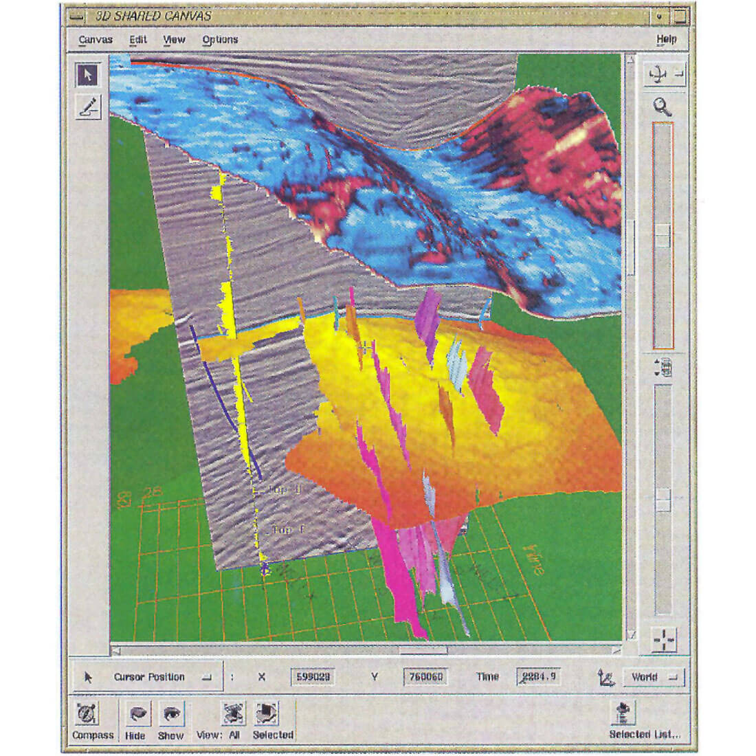
Several visualization techniques presented at Rancho Mirage have had a strong impact, especially on the seismic interpreters. Visualization is certainly the hardware and software area with the greatest potential for development and future use in exploration. Geophysical visualization can be defined as computer dynamic graphical and interactive presentation of multisource geodata. Still and motion, perspective, cube, animation, lighting and other displays can expose hidden information, allow for corrections of 2-D interpretative errors and distortions, and provide the most accurate insight into the subsurface geological setting (real petroleum reservoir world). Simply defined by one of the authors, "visualization allows the interpreter to escape from flatland".
CSEG members contributed to the workshop with 6 well received presentations on 3-D acquisition (Mike Galbraith, SIS); interpretation (Beth Rose, PanCanadian; Fred Kierulf, John Fur et al., Husky Oil; John Downton and Murray Roth, Landmark Canada); visualization (Husky Oil); 4-0 seismology (Fotios Kalantzis et al., U. of Alberta). Other authors, probably ex-Calgarians, presented Canadian 3-D applications (e.g., Ron Ward, LL&E). A workshop book including over 50 well illustrated expanded abstracts authored by leaders of 3-D research and practice was donated by Husky Oil to the Gallagher library at U. of C. and is therefore available to any interested members.
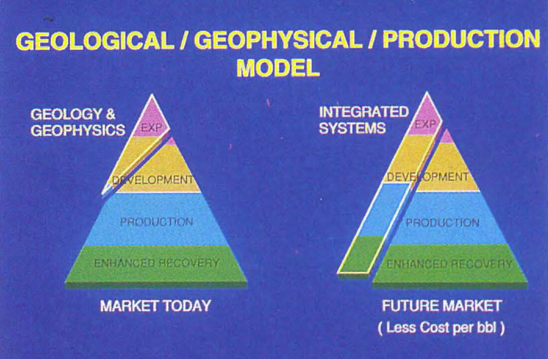
One of the most intriguing conclusions of the workshop was that 3-D is clearly the technology for the 90's, but that more and more surveys will be applied for reservoir characterization and consequently, at least 1/3 of all geophysicists will have reservoir engineering training by the end of the decade!


Join the Conversation
Interested in starting, or contributing to a conversation about an article or issue of the RECORDER? Join our CSEG LinkedIn Group.
Share This Article